Flooding in Whiston |
2007 Summer FloodsThe Summer 2007 Floods in Whiston and Rotherham: an AnalysisWritten and photographed by Matthew Hopps (c) 2011
"We must build dikes of courage, to hold back the flood of fear." Between Monday 25th and Saturday 30th June 2007, following two weeks of consistent rain, South Yorkshire was struck by the worst floods it has experienced for many years. Rotherham and Whiston were both badly affected as the nearby reservoir at Ulley Country Park threatened to burst its banks - causing the mass evacuation of residents; road closures and power cuts that eventually affected hundreds of households. The disruption continued for many days and the cost of damage to village property was eventually calculated at millions. (1) Here, we present a brief analysis in order to understand the processes that led towards the 2007 floods becoming one of the most significant, memorable and difficult events in the region's recent history. |
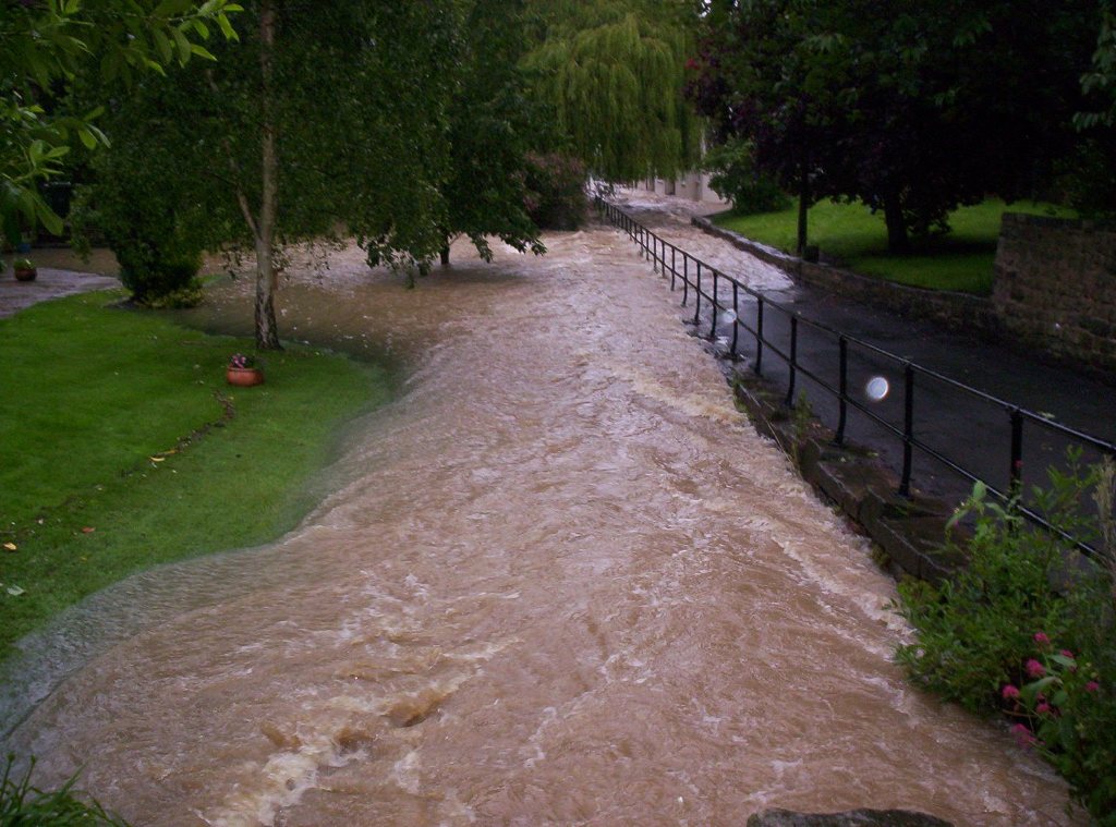
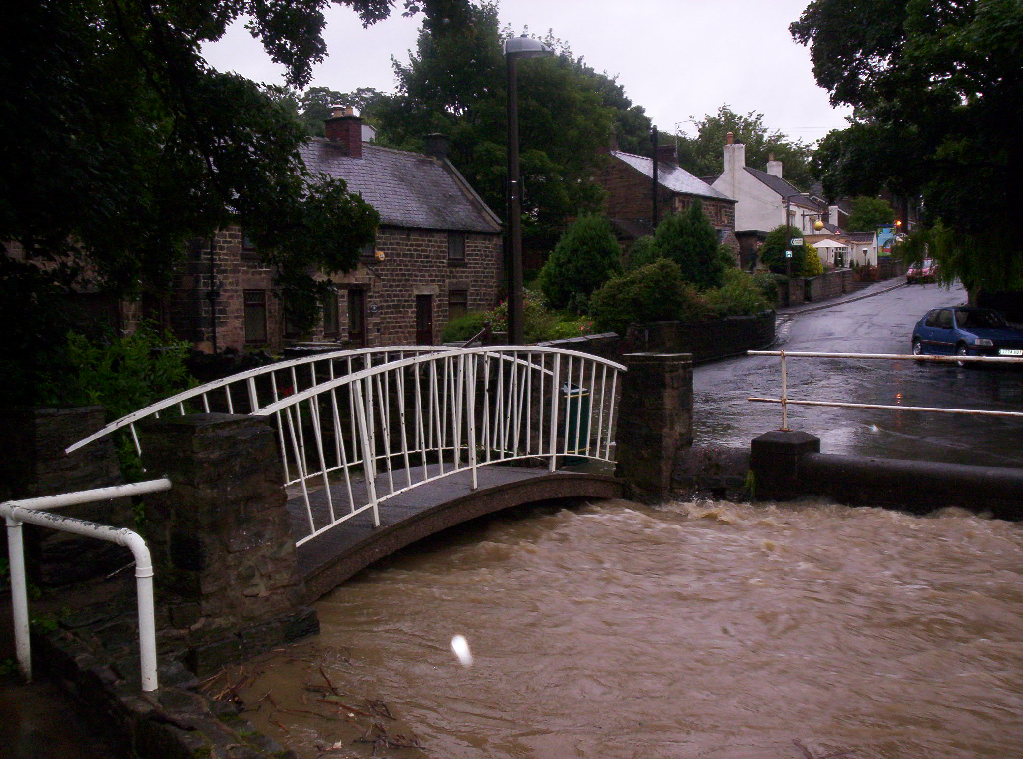
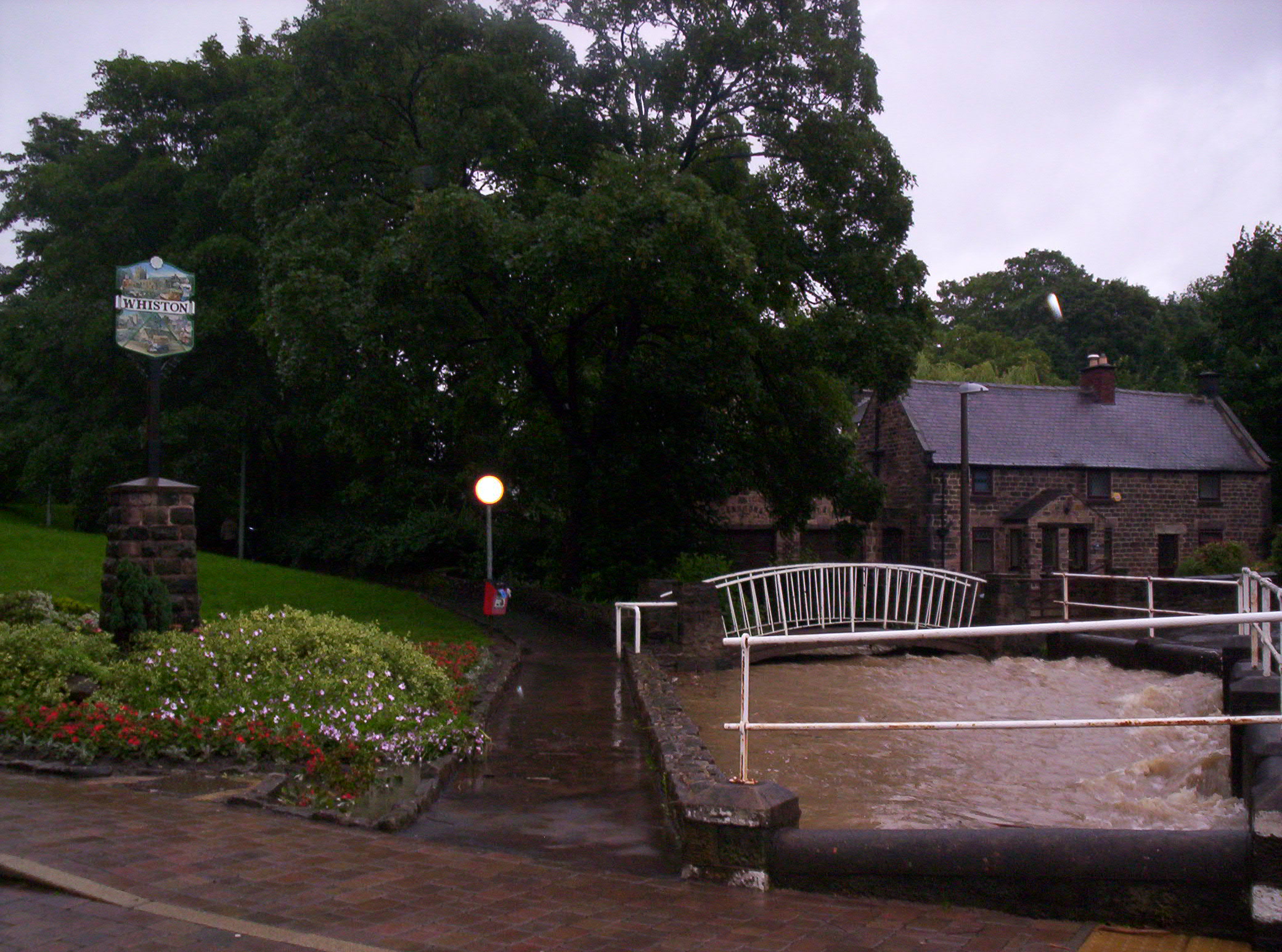
Chronology of EventsMonday 25th marked the conclusion of roughly a fortnight of rainfall – with some areas of Sheffield having endured regionalised disruption a week earlier. According to the Environment Agency, some 90 millimetres fell on South Yorkshire over an 18 hour spell between the 24th and 25th June; and this was already causing some localised flooding in Whiston and Catcliffe by Monday evening (see photos below) (2). However, the problem worsened during the night and at approximately 3.00 a.m. on Tuesday 26th, many residents living in the Pleasley Road and Whiston Vale areas were evacuated from their homes as it emerged that the dam wall at the nearby Ulley Country Park had been damaged and may be about to burst. Displaced residents were relocated to (the now demolished) Herringthorpe Leisure Centre, as well as Dinnington Secondary School; with most eventually returning home by Thursday 28th June. The map below shows the areas affected; with residents living inside the red zone being evacuated or forced to use defensive measures such as sandbags and floodgates to protect themselves and their properties. |
|
|
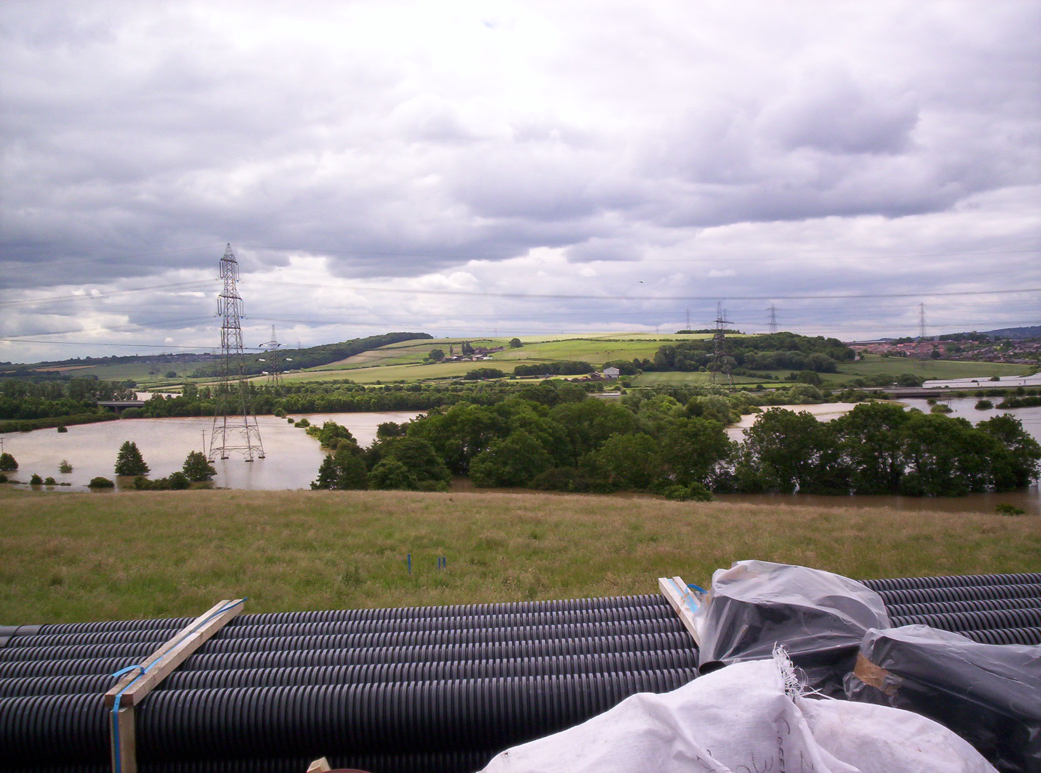
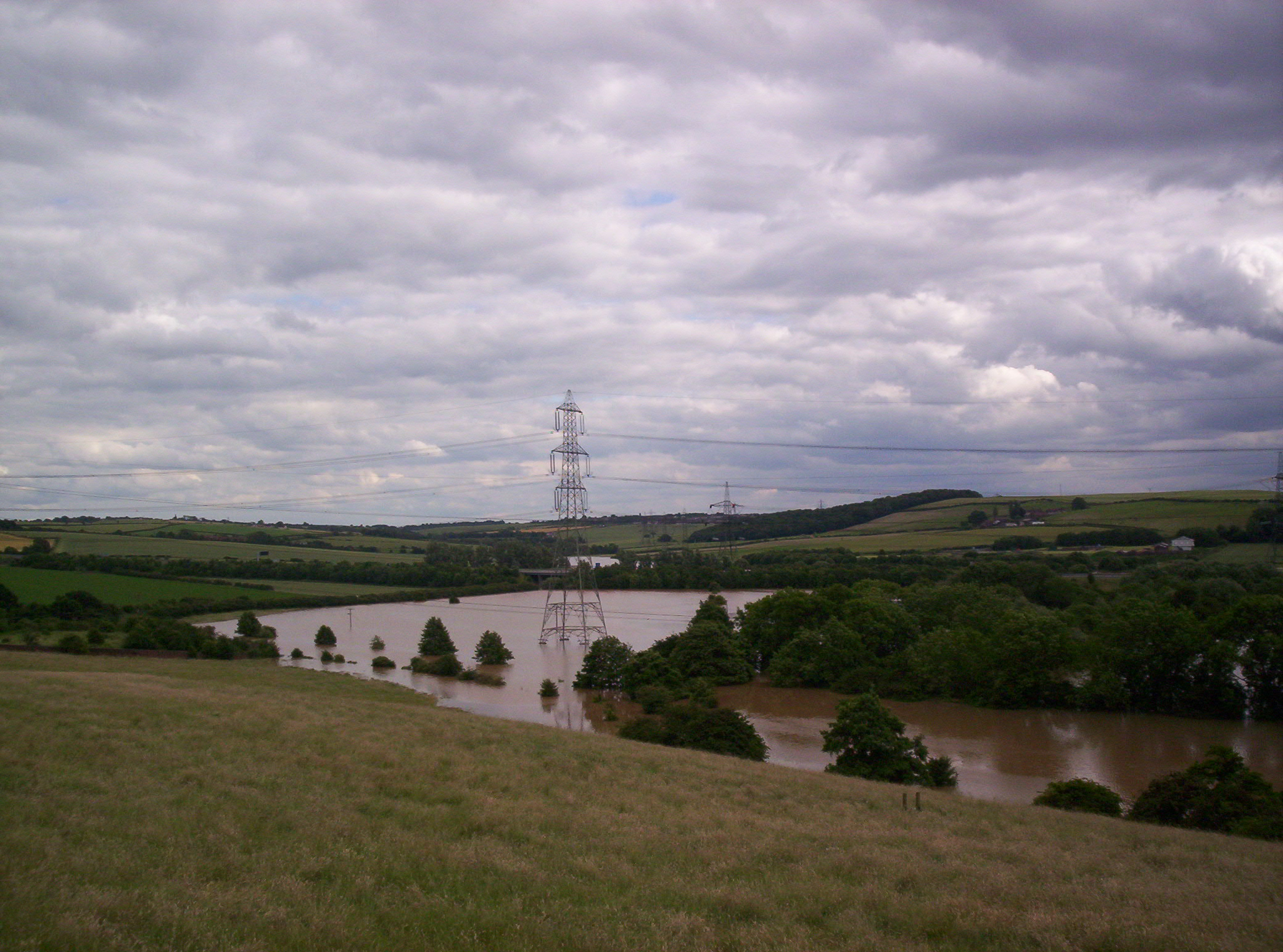
Despite this, throughout Tuesday 26th, Whiston suffered with power cuts, road closures and damage to flooded properties. The full implications of the threat at Ulley became apparent as efforts to prevent a complete disaster continued. Trucks carrying up to 2,600 tonnes of aggregate and dry-bulk materials arrived to stabilise and shore up the dam wall; plus water pumps from as far afield as Surrey, Shropshire and Cumbria were brought in to remove as much water as possible from the lake (3). Initially this work had little success as water from the surrounding drainage basin continued to flow in as fast as the emergency services could remove it; but as the day continued - and with more pumps being used - the authorities began to win their battle against nature in this way. The reservoir would later be drained as part of a major engineering, reconstruction and restoration program that took three years to complete* (4). |
|
CASE STUDY - DELFT COTTAGE: |
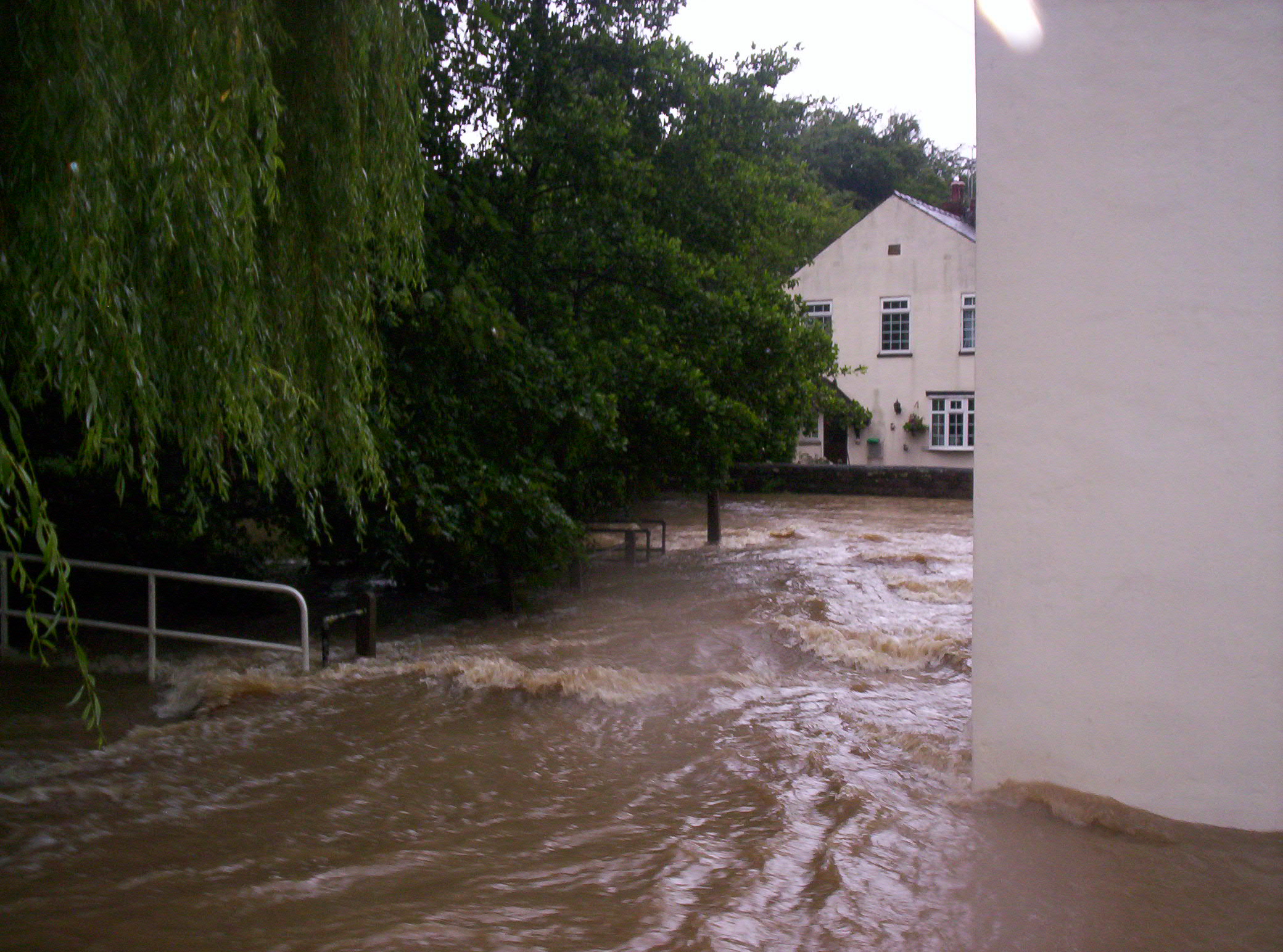
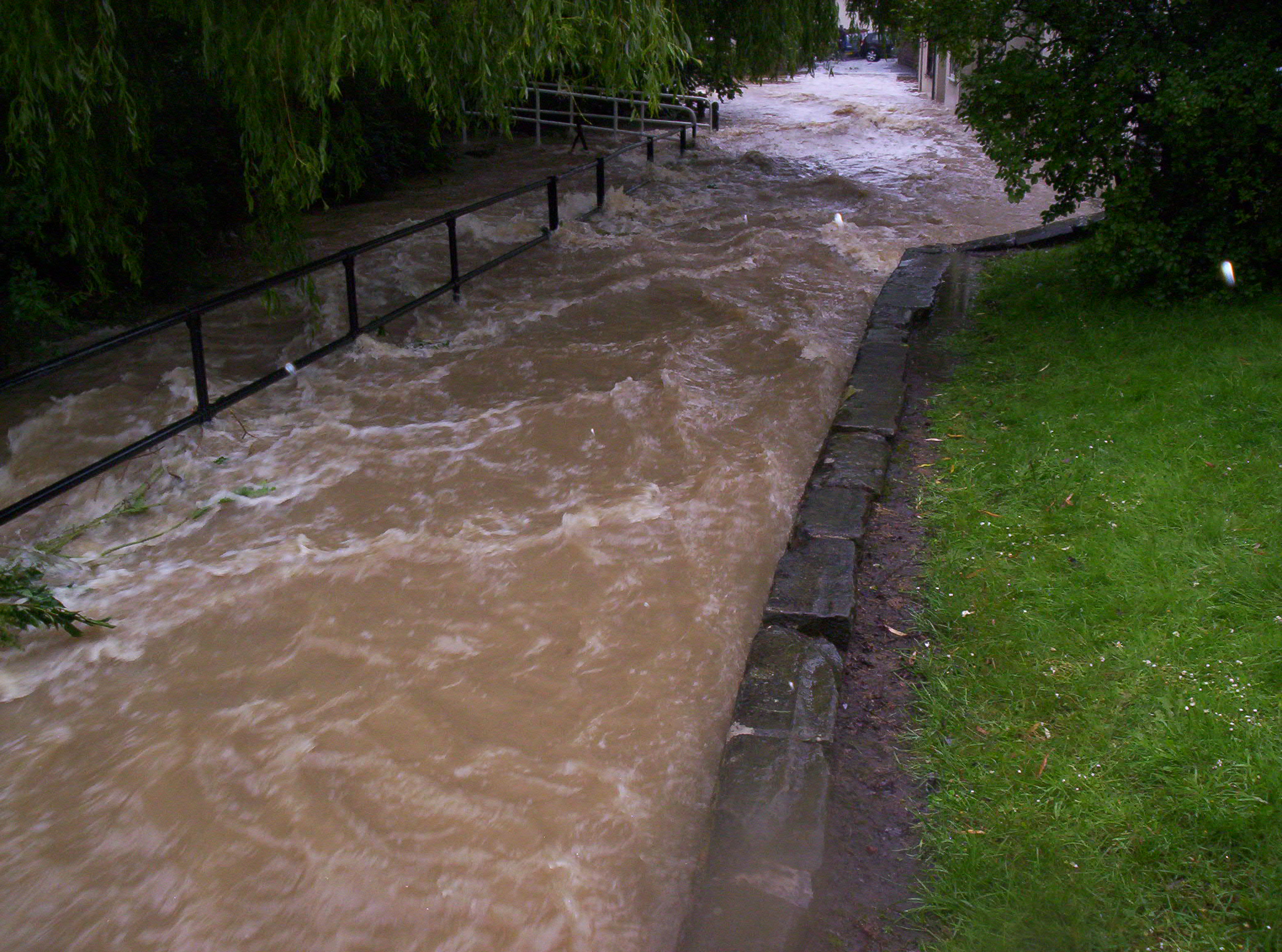
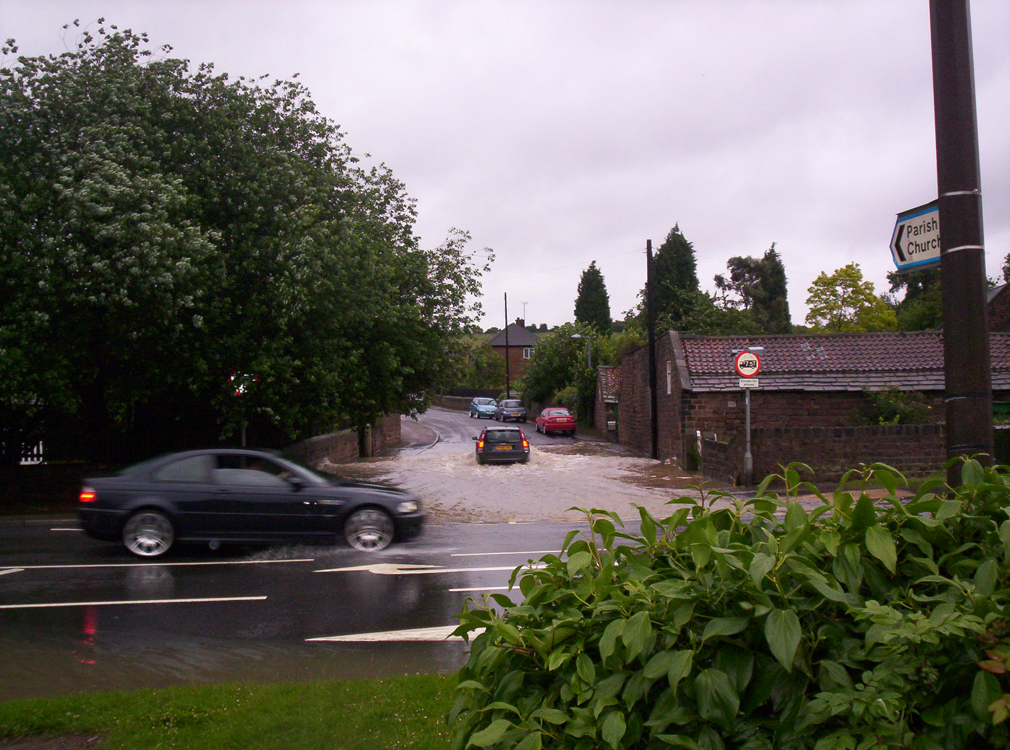
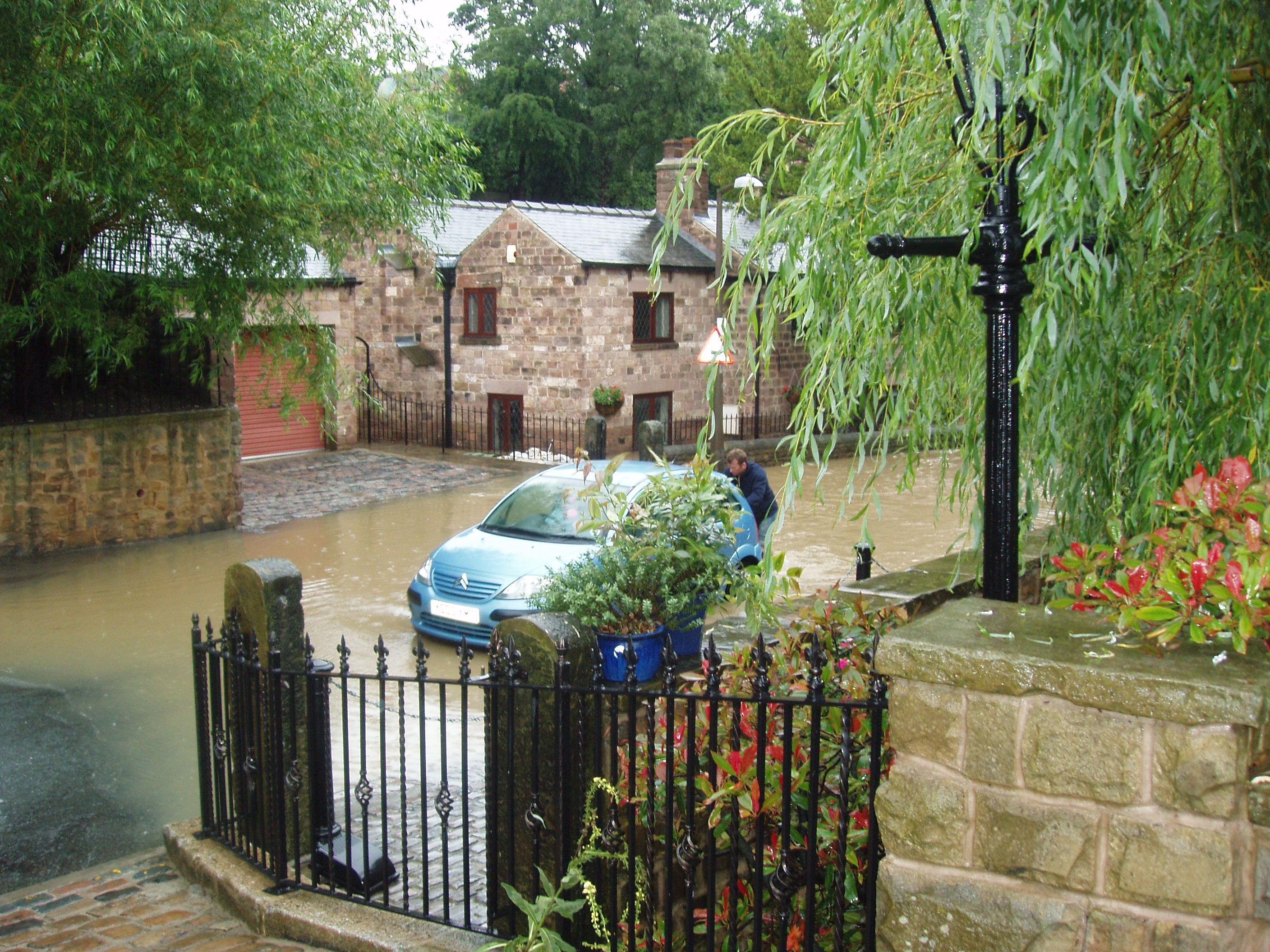
What was the Problem?The topography of the area is such that, had the dam burst, the water would have run down towards Junction 33 of the M1 motorway and the electricity substation that is located adjacent to it; thus threatening power supplies to much of the Sheffield and Rotherham conurbations. From there (and having engulfed both the carriageway and the River Rother - which at this point meanders through a low-lying, flood plain area) the water would theoretically have run on towards the town centre (flood barriers notwithstanding); joined with the River Don and thence through Rotherham itself. What is more it would have also backed up at the River Rother - into which the Whiston Brook flows - and thence further upstream through the middle of the village along High Street and Moorhouse Lane. This flood plain area, located downstream of Ulley reservoir, was already overflowing to a depth of several feet. This is why households in the aforementioned areas were evacuated as they were at the greatest risk of being inundated by excess foodwater. In addition, the M1 motorway was also closed between junctions 31 and 34 for a total of 40 hours; thereby spreading the disruption further afield. Fortunately this worst-case-scenario did not come to pass and yet, despite all of these precautionary efforts; as we can see from the images at the bottom of the page; many properties along the line of Whiston Brook were flooded (some to a depth of between five and six feet!). Rebuilding work has taken much time and effort, with the most severely damaged properties taking up to two years to be repaired completely. |
Geographical CausesSo far then, we have seen that; within the space of a few days; excessive rainfall triggered a chain of events that not only damaged, disrupted and displaced hundreds of people, their property and possessions; but also threatened to destroy infrastructure across the region had the subsequent floodwaters not been brought under control. But why did such severe flooding happen? According to Paul Hudson ('BBC Look North' Weatherman), the problem first of all is that Sheffield and western Rotherham are located in a natural bowl; surrounded by hills; and also lie at the confluence of three rivers (the Don, Rother and Sheaf). Secondly, at the source of the Don – high in the Pennines – much local peat that would otherwise absorb rain water, has (for years) been removed for use as fuel; therefore leaving more liquid free to run off the surface land and into the infant tributaries. Thirdly, much of the terrain in the surrounding drainage basin was already saturated from previous poor weather two weeks earlier and was thus unable to absorb any more liquid. All of which meant that excessive amounts of water – millions of gallons in total – flowed downstream towards Sheffield. What is more we can see that the river has been constricted by both urban development and culverts as it passes through the city centre. This forces it into narrower channels at the point it should be starting to meander (academic reference). Consequently this pushes the water in the only remaining direction it has available - upwards. As a result the rivers breached their containments on 25th June 2007 and spilled out onto (and into) not just the surrounding land but also its infrastructure; causing the natural disaster that we see here. Finally, released of some of its bottlenecked energy, the water rushed towards flood plains beyond Sheffield that are now occupied by property – such as at Catcliffe (DVD). In summary, urban land use and other human activities modify the landscape to such an extent that they influence the behaviour of both excessive, and peak, water discharges. This suggests that river levels can only rise during both heavy rainfall and periods of snowmelt as there is nowhere else for the extra water to go. This is the natural and geographic system that, on a smaller scale, also took place at Ulley during this week. |
The Clear-Up BeginsTowards the end of the week the floodwaters receded in Sheffield and Rotherham and attention turned towards the clear-up operation. In addition; with the literal threat largely over, the emotional and economic consequences began to be felt more harshly. Most Whiston residents were allowed to return to their homes by Thursday 28th, with little reports of injury or illness. Yet the problems did not go away but simply moved downriver; as the excessive current transferred eastwards in a shockwave effect; infiltrating several areas of Doncaster such as Toll Bar, Bentley and Thorpe Marsh power station. The latter required the aid of both the RAF and Army to keep it online by shoring it up with sandbags. |
Early evening - Monday 25th June 2007
|
|
In the aftermath of the floods, Ulley Country Park was closed and the lake drained completely to allow a major clean-up operation to take place. Over the next three years a £4 million re-engineering scheme was then carried out to construct a concrete spillway; reminiscent of the river engineering systems in place in low-lying urban areas such as Los Angeles and the Netherlands coast (ref). The previous dam wall was an organic Victorian-era construction with a small overflow system (ref). As a result of the June 2007 floods, it became clear that this wall was susceptible to complete failure with little more than the sheer force of a large volume of water. But with these measures in place, it is hoped that such severe flooding, and potential danger, will never happen again. The new dam wall reopened on 25th June 2010 to commemorate the third anniversary of the disaster, and has since (as of spring 2021) proved effective in managing the water levels within the lake. Final Thought:The 2007 floods were remarkable in their extent and severity and sadly, appear to have set a trand for June or July-based flooding events. Summer rainfall can often be heavy but is usually of short duration (Environment Agency ref). What was striking in this case was the length of the rainfall: triggering off a chain of events that thankfully resulted in few fatalities or serious injuries; at least in the Whiston area (despite the drama of a late night evacuation); other communities in the Sheffield area were not so lucky. On the other hand it showed how unprepared we can be when Mother Nature plays one of her cruelest cards. Nonetheless, as we have seen first of all with the reconstruction and reopening of Ulley Country Park; then with the complete rebuilding of Delft Cottage, and finally with the rehabilitation and general recovery of the village holistically, the residents of Whiston and Rotherham demonstrated their ability to overcome the difficulties and showed their determination not to be defeated by them. After the danger, damage and disruption of the week, BBC Look North produced a commemorative DVD of the 'Great Yorkshire Floods' and this stands as a record of these dreadful events. It also acts as the source of much of the information presented in this article. Any claims not acknowledged are taken from this DVD whilst all other sources are listed below. |
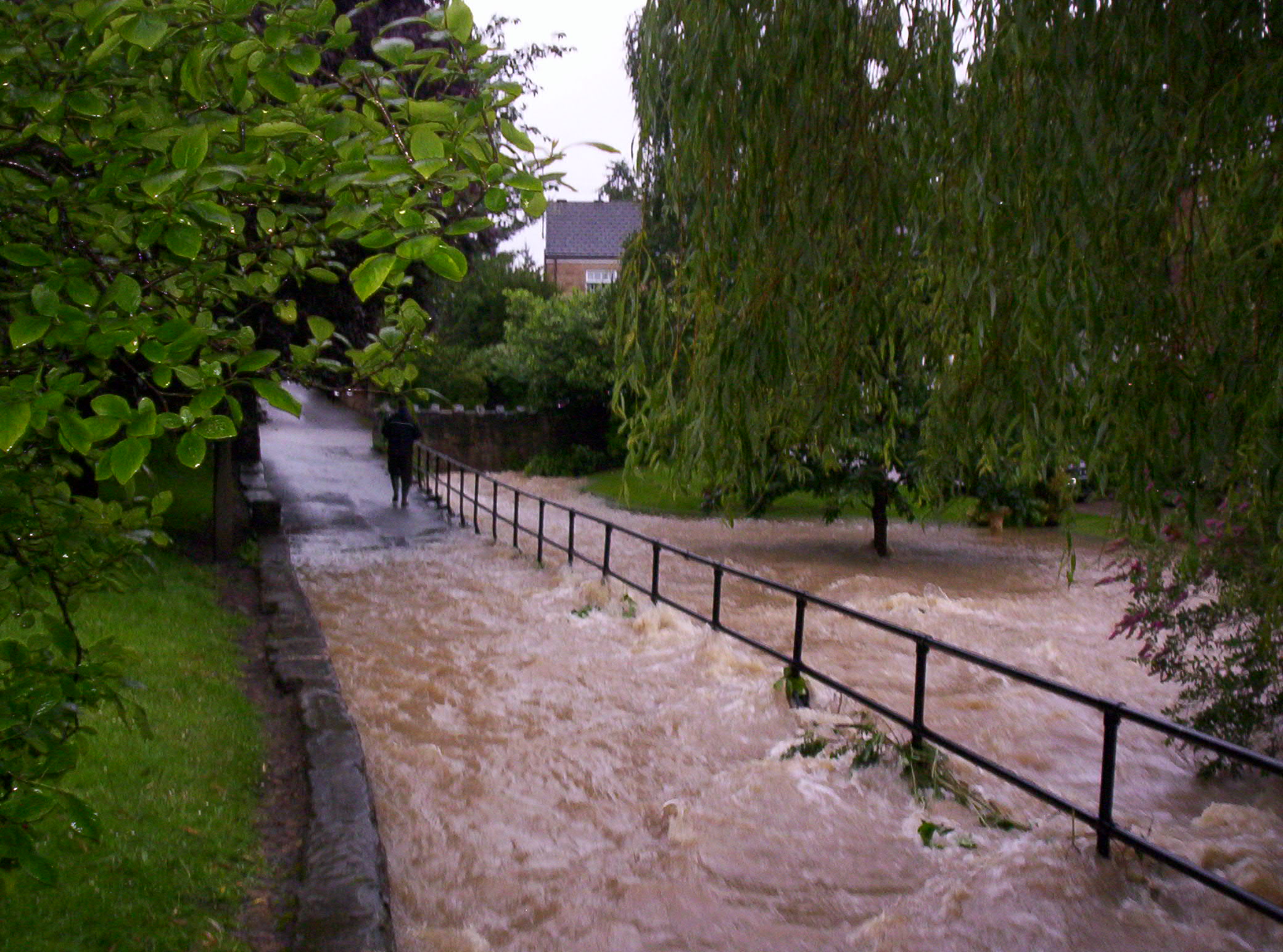
2019 Autumn FloodsUnfortunately, the events of 25th and 26th June 2007 were not to be a one-off. Whiston suffered a second round of serious flooding on 7th November 2019. At first sight, it appeared as if the two events played out in a very similar way to each other. However, on closer inspection there werer some differences. This flooding once again occured due to an intense period of heavy rain in the Rotherham and Sheffield areas over the 36 hours before flooding began (5). Water again fell onto ground already saturated from earlier, prolonged, rainfall at the end of October 2019. However this time around, with the engineering works at Ulley having been completed; and thus a functioning spillway in place to control the water level in the reservoir; there was no threat of a dam collapse, so there was no evacuation like there had been in 2007. However, there appeared to be one mitigating factor that actually made the 2019 flood even worse than it had been 12 years earlier. First of all there is a Yorkshire Water Pumping Station in Whiston, located at Worrygoose Lane roundabout; and in November 2019, that appears to have been used to draw water from the Brecks and Wickersley areas (in order to prevent them from flooding) and deposit it into Whiston Brook at the point where it passes by the end of Worrygoose Lane at its junction with Moorhouse Lane. From there this extra water then travelled downstream to flood first Moorhouse Lane and then further along into the heart of the village. This meant that Moorhouse Lane was flooded in at least two places, including at its junction with Moorclose Close; a site that did not flood in 2007; and then for a second time further along Moorhouse Lane by Delft Cottage; to a greater extent than before. As can be seen in the image above; several motorists were caught out by the depth of the water as the road dips down slightly at this point, so is closer to the level of the Brook. In essence, in 2019, Whiston was flooded by non-Whiston water. Here is an extract from a 2014 edition of the Whiston Village, which indicates that extra water has been pumped into the Brook for a long time:(6) Ralph Bartle of Brook Street, Whiston writes: "I would like to thank the people who live and work around Whiston brook/river, for their contributions in the village’s fight to stop the brook from future flooding and to prevent contaminated water being discharged into the brook, from the Worrygoose Lane pumping station and from the Tanyard at Wickersley." In summary, as far as is known, flooding of this nature has only happened on these two occasions (at least in modern times). One the other hand, at least 27 properties were flooded in Whiston in November 2019 under circumstances that could have been either avoided or better controlled; which then placed an emphasis on Rotherham Council and other authorities with regard to what action they should (and would) take to prevent this from happening again (7). To that end the Environment Agency installed a depth gauge monitoring device by the bridge on Moorhouse Lane; so that they can keep an eye on the water levels. The only other remedial work has been further downstream at Whiston Meadows where the Brook joins the River Rother; with better flood control / sluice gates in place to control the water as it then flows on through the town centre; ensuring that any flooding is contained within the flood plain by the motorway at Juntion 33. It is hoped that these measures, together with effective emergency planning, preparation and management; will see future heavy rainfall contained within the Brook so that local residents won't have to suffer the stress, difficulty and misery of being flooded or displaced any more; and these events, whilst being recorded for posterity, can be cosigned to memory.
|
* A technical explanation of how and why the dam wall partially collapsed can be found on the 'Friends of Ulley Country Park' website here. Furthermore, there is also a concise description of what happened on the information boards that can be found at Ulley Country Park itself.
Footage of the 2007 Floods:
|
|
References: Pages 49-55. Other References: Further Sources: |

|